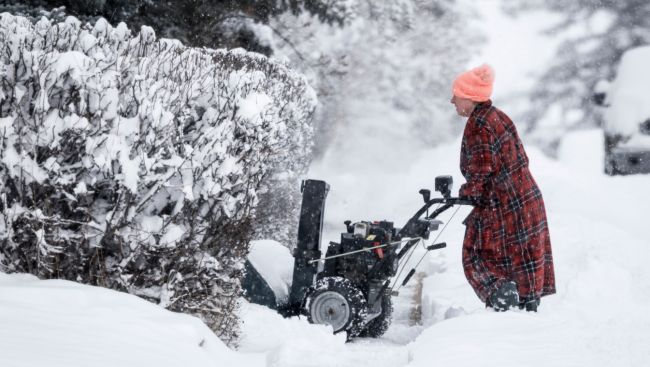
Blasts of frigid Arctic air could send temperatures tumbling in December and herald the arrival of a more "traditional Canadian winter," a meteorologist for the Weather Network predicts as it releases its seasonal outlook.
Most of Canada is expected to see near or colder than normal temperatures, and near or above normal precipitation and snow, says the network's seasonal forecast for December, January and February.
There's still some uncertainty about whether the second half of winter's fury will be widespread or more focused on Western Canada, said meteorologist Doug Gillham.
What's more certain is that it will be "December to remember," he said. The forecast isn't necessarily calling for a "historically severe winter," Gillham said, but "it's going to be a colder December and January than we've really become accustomed to seeing in many recent years."
"When you step back and look at big picture, winter will show up this year and it's going to show up in a big way to start the season."
The country experienced its warmest winter on record two years ago ahead of last year's more typical season, Gillham said. This year is expected to look more like last year, "but the signals for cold are actually a little bit stronger," Gillham said.
One of those signals is the polar vortex, strong winds circling up to 50 kilometres above the Arctic that keep frigid air locked near the poles. A period of surging temperatures up in that part of the atmosphere is expected to disrupt the vortex and spill that cold out over Canada in December and January.
A second consecutive winter with a weak La Nina is also set to have a cooling influence, Gillham said. The climate pattern, tied to shifting patches of water in the Pacific Ocean, can often lead to colder and stormier conditions across much of Canada.
Put those two things together, the disrupted polar vortex and the weak La Nina, and the potential goes up for extended stretches of extreme temperatures, he said.
"So, if you enjoy winter activities, that's good news. If you think, 'I don't need snow tires anymore,' well, you may want to rethink that," Gillham said.
What counts as a typical or normal Canadian winter has changed over recent decades. While they fluctuate, average winter temperatures are about 3.7 degrees warmer now than in the mid-20th century as climate change, driven by the burning of fossil fuels, reshapes Canada's winter way of life.
Yet the baseline used to figure out what's "normal" for the forecast is a more recent period, between 1991 and 2020.
British Columbia's coast, including Victoria and Vancouver, is largely shaping up for near normal temperatures and precipitation — albeit with some ups and downs, and perhaps a drier than usual north coast, the forecast suggests. The cooler temperatures start to show up in eastern British Columbia, paired with more snowfall than normal for the southern Rockies and Kootenays.
Alberta is expected to see colder than normal temperatures dominate this season, though the pattern will relax at times, Gillham said. Snowfall totals could be higher in the southern and central Rockies and through Calgary, with near-normal totals for the rest of the province, including Edmonton through Fort McMurray.
The forecast's strongest signals for cold show up in Manitoba and Saskatchewan.
"When it's cold, it will be severely cold. And the influences of the polar vortex mean your cold shots, which are typically cold, will be even colder," Gillham said of that region.
There are signs the cold there could linger well into March. Some will be longing for spring warmth by then, but a delayed spring start can bring some benefits to the Prairies, Gillham noted. A cooler spring can maintain the snowpack, keeping up soil moisture and helping cut into early-season wildfire risks until rainier days arrive.
The region is expected to see typical snowfall across the board, with the best chance for above-normal totals in southwestern Saskatchewan.
The abrupt and early switch to winter in parts of Quebec and Ontario is expected to continue and deepen, Gillham said. There is expected to be more winter weather leading up to and through the holidays than the region has seen in recent decades.
Across both provinces, the first half of the season is expected to be colder than normal but there's more uncertainty in the back half, with the potential for a more changeable and inconsistent season, Gillham said. Precipitation and snowfall are also expected to be above normal across southern Ontario and into Quebec, with closer to normal levels in the north.
In Atlantic Canada, the picture is a bit more changeable, Gillham said. The focus of the consistent cold is expected in the first half of the season, but with back-and-forth temperatures that eventually come close to offsetting each other.
The milder periods could end up outweighing the cold in Newfoundland and Labrador and the southernmost parts of Nova Scotia, he said.
Parts of Nova Scotia, including Halifax, and eastern Newfoundland, including St. John's, could also see below normal snowfall.
"Now again, especially St. Johns, the normal winter has a lot of snow, so we do expect a lot of snow, just less than is typical," Gillham said.
For the territories, near-normal temperatures are expected across Yukon and the Northwest Territories, and into southern parts of Nunavut. The rest of Nunavut is expected to see above normal temperatures, partly because of the disrupted polar vortex, Gillham said.
It's a good forecast for ski lovers in the Rockies, southern Ontario and southern Quebec, with resorts in those areas set to be well-covered for the holidays, Gillham said.
In fact, "the bigger concern" in southern Ontario and southern Quebec may be getting to the ski hill, given the possibility for some high-impact lake effect snowstorms and snow squall events, he said.
For skiers in B.C.'s south coast, there are some concerns about how much natural snow will fall to start the season, but Gillham says overall conditions are still expected to be near normal. On the flip side, the good news is that there's less of a threat this year of a pineapple express, a pattern where very mild air brings rain high into the alpine regions.
As for a white Christmas, it's still a bit early to make that prediction, Gillham said.
"But when we step back — the high level, the country as a whole — I think more of Canada will see a white Christmas than we often do and especially southern Ontario, southern Quebec," he said.
"That doesn't guarantee that your backyard will be white, but with the strong start to the season, we think more of the country, but not everyone, will see a white Christmas."
Picture Courtesy: THE CANADIAN PRESS/Jeff McIntosh


